MEB’s library of maps
One of the main goals of the MEB-network is to create high-resolution gridded microclimate products for use in ecology. Our first such products can be found here below. We are working on a new, interactive way to have you access and download such microclimate data for wherever and whenever would be of interest to you. But for now, we have the following datasets available:
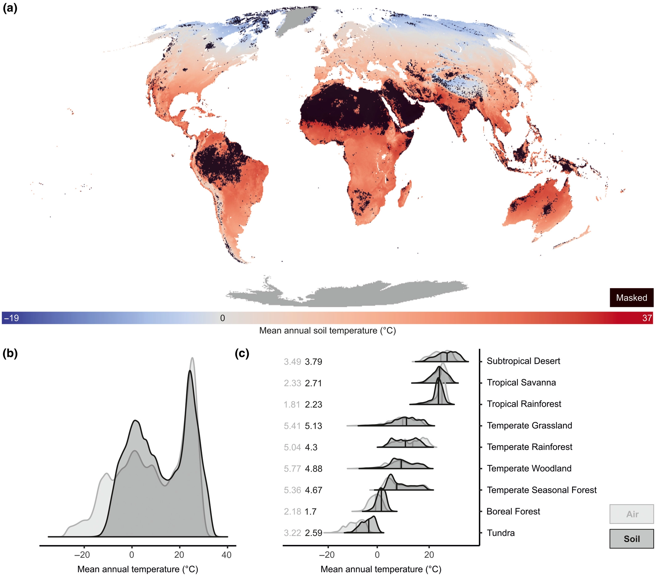
– Global maps of soil temperature
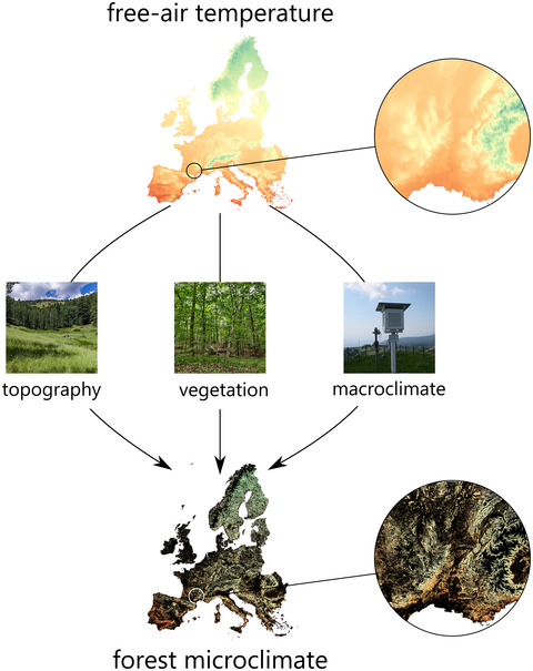
– Maps of European forest understory temperature
– Maps of pan-tropical forest understory temperature
See below for more details!
SoilTemp maps: Global maps of soil temperature
Resolution: ~1 km²
Height: 0-5 or 5-15 cm belowground
Type: bioclimatic variables
Paper: Lembrechts, J., Van den Hoogen, J., et al. (2022). Global maps of soil temperature. Global Change Biology. https://doi.org/10.1111/gcb.16060
Maps (GeoTIFFs): https://zenodo.org/record/7134169
These layers are also publicly available as Google Earth Engine assets. These are accessible via:
- https://code.earthengine.google.com/?asset=projects/crowtherlab/soil_bioclim/SBIO_v2_0_5cm
- https://code.earthengine.google.com/?asset=projects/crowtherlab/soil_bioclim/SBIO_v2_5_15cm
Source code and data: https://doi.org/10.5281/zenodo.4558663
ForestTemp: sub-canopy temperatures of European forests
Resolution: ~25 m²
Height: 0-100 cm aboveground
Type: bioclimatic variables
Papers:
– Haesen, S., Lembrechts, J. J., De Frenne, P., Lenoir, J., Aalto, J., Ashcroft, M. B., … & Van Meerbeek, K. (2021). ForestTemp–Sub‐canopy microclimate temperatures of European forests. Global Change Biology, 27(23), 6307-6319. https://doi.org/10.1111/gcb.15892
– Haesen, S., Lembrechts, J. J., De Frenne, P., Lenoir, J., Aalto, J., Ashcroft, M. B., … & Van Meerbeek, K. (2023). ForestClim—Bioclimatic variables for microclimate temperatures of European forests. Global Change Biology. https://doi.org/10.1111/gcb.16678
Maps (GeoTIFFs): https://doi.org/10.6084/m9.figshare.14618235
Tropical forest understory temperature
Resolution: ~30 m²
Height: 15 cm aboveground
Type: bioclimatic variables
Paper: Ismaeel et al. (2024). Patterns of tropical forest understory temperatures. Nature Communications. 15, 549. https://doi.org/10.1038/s41467-024-44734-0
Maps (GeoTIFFs): https://doi.org/10.23729/dd3de08e-39a1-46b0-b28a-7bc577b6c914 (300 m resolution – 30 m available upon request)


